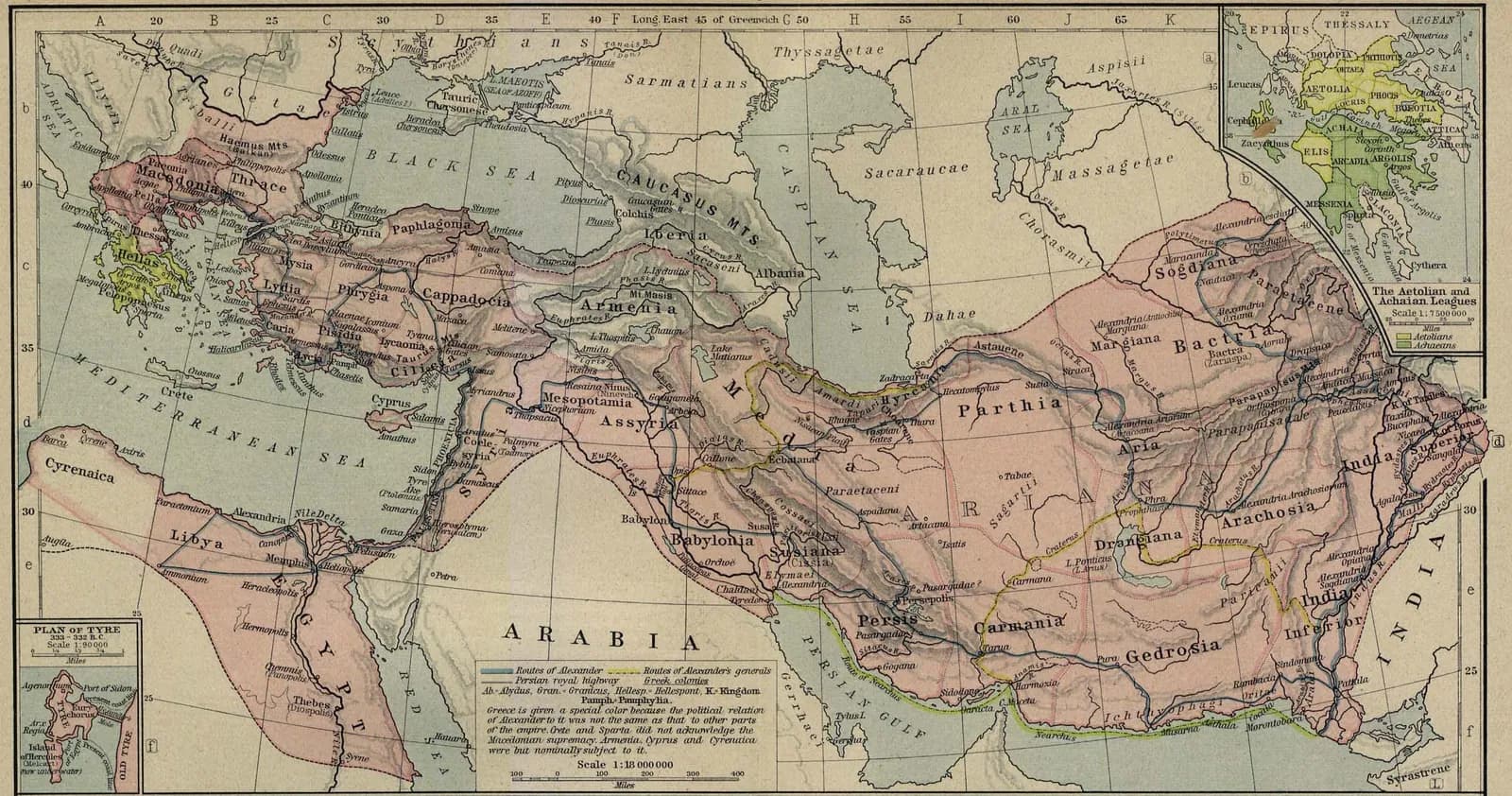
In a single decade (334–323 BCE) Alexander led the Macedonian army from the Aegean across Asia Minor, through Syria and Egypt, into the heart of the Persian Empire, and on to the Indus — winning the great battles of Granicus, Issus and Gaugamela and founding cities (above all Alexandria) along the way.
The empire he conquered was essentially the Achaemenid realm, taken over largely intact. He built no governing institutions of his own and arranged no succession, and at his death at Babylon in 323 BCE the empire fractured among his generals into the Hellenistic kingdoms — Ptolemaic Egypt, the Seleucid Empire, and Antigonid Macedon.
Key locations
- Pella — The Macedonian capital, Alexander's starting point.
- Issus — Site of the 333 BCE victory over Darius III in Cilicia.
- Gaugamela — Site of the decisive 331 BCE victory in Mesopotamia.
- Alexandria — The greatest of Alexander's foundations, in Egypt.
- Babylon — Where Alexander died in 323 BCE.